
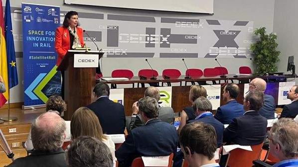
HELD under the Spanish presidency of the European Union (EU), the Space for Innovation in Rail conference was hosted by Cedex, the civil engineering research centre that reports to Spain’s Ministry of Transport, Mobility and the Urban Agenda (Mitma) and whose work also includes rail interoperability. Heading the keynote speakers during the opening session on September 13 was Ms Carmen Libero, a special commissioner at Mitma appointed to oversee the transport and mobility aspects of Spain’s national recovery plan, including major rail infrastructure projects.
Libero said that Mitma was aware of the “enormous contribution” that space technology could make to the rail sector as a key component of Europe’s sustainable transport system, and urged the industry to adopt the latest innovations in digital green technology “to reach its full potential,” while “paving the way for it to increase its profitability and operate even more safely. As well as satellite navigation systems, it is fundamental to have a robust communications infrastructure for data transmission between trains and control centres,” she said.
“I think space technology could improve that type of communication and provide many other benefits, such as monitoring infrastructure condition,” Libero told IRJ. “That is very important and Spain sees it as a clear opportunity for the railway sector.”
In her keynote speech, Libero pointed to the potential of the Iris2 secure satellite communications network being developed by the EU as a means of providing reliable communications infrastructure for railway operations, such as in remote areas or where terrestrial networks are not available.
The European Commission (EC) has overall responsibility for the Iris2 programme, with its development overseen by the European Space Agency (ESA) and its operational management undertaken by the European Agency for the Space Programme (EUSPA), one of the joint organisers of the Madrid conference alongside the EC, the Europe’s Rail Joint Undertaking (ERJU) and the European Union Agency for Railways (ERA).
The objectives of the programme were outlined in a later presentation by Mr Helmut Spitzl, Iris2 project control and quality manager at the EC’s Directorate-General for Defence Industry and Space (DG DEFIS). Complementing existing EU infrastructure, Iris2 will be based on a low earth orbit satellite constellation to provide secure, high-quality, reliable and cost-effective communication services to governments and government-authorised users, such as railway infrastructure managers. It should also allow quicker transmission of data by satellite, with a latency or transmission time of 30-50ms. This compares with 125-250ms for a medium earth orbit or 600-800ms for a geostationary orbit at an altitude of 36,000km, while Iris2 will be in orbit at an altitude of 600 to 1200km.
“I think space technology could improve that type of communication and provide many other benefits, such as monitoring infrastructure condition.”
Ms Carmen Libero, a special commissioner at Mitma
With development taking place in 2023-24, initial Iris2 services should be available from the start of deployment in 2025, with this phase of the project running into 2026 and 2027. Full services are planned by the end of 2026. EUSPA market development technology officer, Mr Flavio Sbardellati, said that Iris2 would enable government satellite communications and commercial services such as high-speed internet broadband to enter a new era and transition to an interoperable and standardised system built and operated by the EU. “Users are at the heart of this transition,” he said, adding that EUSPA has analysed 192 use cases for the new system including rail traffic management. “Iris2 will provide services anywhere, regardless of geographical location or environmental conditions.”
Sbardellati described Iris2 as an ideal complementary technology for terrestrial telecommunications networks but also with the potential to lower the cost of ERTMS based on the GSM-R radio. “According to an ERA study, the cost to deploy a dedicated terrestrial network is around €60,000 per km,” he pointed out. “Iris2 can possibly help lower the cost of this investment.”
Potential applications include extending coverage to rural areas that would be difficult to reach with a terrestrial network, or reducing the number of radio base stations required. As well as providing coverage beyond the reach of terrestrial networks, Sbardellati said that secure satellite communications could also provide a back-up in case of network outage or if terrestrial networks were compromised. “Extensive testing will of course be required to assess to what extent these possible combinations are feasible, and what are the limitations,” he said, such as the impact of tunnels, bridges and mountainous terrain on signal reception.
Train location by satellite
As well as reducing the cost of communications infrastructure, satellite technology also has the potential to provide a more cost-effective solution for determining train location under ERTMS, when compared with trackside equipment that requires significant capital expenditure as well as ongoing maintenance support. Several research programmes are now underway that are seeking to exploit the potential of Galileo, the EU’s global satellite navigation and positioning system (GNSS), as well as the European Geostationary Navigation Overlay Service (EGNOS). This is a regional satellite-based augmentation system (SBAS) that improves the performance of Galileo and other global systems. EGNOS has been deployed in safety-critical applications such as navigation services for civil aviation, and is now in operation at over 400 airports in 26 countries.
The European Rail Industry Association (Unife) is coordinating the development of a certifiable train location unit with GNSS under the Clug 2.0 project, which commenced in February and is due to be completed in January 2025. The 10 project partners include French National Railways (SNCF) as technical lead, German Rail (DB) and Swiss Federal Railways (SBB), and from the supply industry Airbus, CAF, Siemens and GNSS equipment manufacturer Syntony.
The objective of Clug 2.0 is to develop an onboard multi-sensor architecture based on GNSS and EGNOS that will provide absolute safe train positioning to complement the existing ETCS odometry system, taking into account user needs and system requirements. A live trial will be held in Switzerland using a test train to demonstrate in real time the data fusion algorithms developed as part of the project.
The use of GNSS for train positioning in rail traffic management and ultimately automatic train operation (ATO) has been one of the use cases examined by the Helmet project to develop a high-integrity European GNSS (EGNSS) layer for multimodal ecofriendly transport. Mr Francesco Rispoli, director general of Radiolabs, said that trials conducted on Italian Rail Network (RFI) infrastructure in Sardinia demonstrated that train position could be determined with an accuracy of within 10m using GPS and EGNOS. Combining GPS, Galileo and EGNOS increased this accuracy to within 6m, and Rispoli believes that determining train location to within 2m is achievable. The trials have been conducted on the double-track line between Cagliari and Decimomannu in Sardinia, which has a maximum speed of 150km/h, using a class Aln 668 diesel railcar.
Building on Clug 2.0 and work in the earlier Shift2Rail programme, the use of EGNOS for train positioning will be further developed under one of the EUJU’s six flagship research projects, FP2 R2Dato. This aims to deliver automatic train operation (ATO) up to Grade of Automation 4 (GoA4) by 2030, in order to increase the capacity of existing infrastructure by reducing headways and avoiding the cost and complexity of building new infrastructure.
As SNCF project director, Mr Frédéric Villot, explained to the conference, R2Dato has a budget of €160.8m “so it’s a big project,” involving 12 operators and infrastructure managers as well as 13 suppliers. This combination of the supply industry and railway companies that will use the new technology was “a key point,” and should lead to a good solution to providing “a modular train on digital infrastructure,” he said.
The project team began work on December 1 2022 and R2Dato is due to end on May 31 2026. At the start, R2Dato was expected to examine the use of GNSS, but following discussions with ESA and EUSPA the project partners agreed to modify the programme for work on one of the project’s technical enablers, TE2 for Train Positioning, to include EGNOS. The objective is to have six EGNOS demonstrators ready in 2025, and using this existing technology should enable a “fast and effective” solution to be developed, Villot said.
As rolling out new technology was often “very difficult on the railway,” Villot pointed out that one of R2Dato’s work clusters covered “fast and effective deployment,” with one of its constituent technical enablers, TE20, specifically dedicated to deployment and migration. Using satellite technology for absolute safe train positioning will reduce system costs by removing the need for trackside equipment and replacing it with onboard technology, Villot said, “but it will increase costs for the operator, so we also need to have a debate between operators and infrastructure managers on how we split this increase and reduction in costs.”
The specific contribution that satellite train positioning can make to lowering the infrastructure and operating costs of low-density lines, while increasing capacity and performance, will be examined by a second EUJU flagship project, FP6 Future. This has the overarching objective of developing solutions to revitalise feeder lines and regional rail services by reducing the total cost of ownership. In his presentation on Future, Mr Alessandro Mascis, vice-president of digital intelligence at Wabtec, described the €35m research project as “the little sister” of R2Dato that will use many of the technical enablers developed by the larger programme.
Future divides regional lines into two categories, with Group 1 comprising those that are connected to the mainline network and where interoperability must be maintained, potentially deploying solutions developed by R2Dato. Group 2 encompasses lower-density lines that are not physically or functionally connected to the mainline network, and where interoperability is not an issue. “Here we can relax the constraints of interoperability,” Mascis said, “but we have a goal to ensure standardisation.”
For Group 1 lines, Future will work closely with R2Dato to provide demonstration sites, requirements and use cases to apply satellite train positioning to the maximum extent possible. “They clearly represent an easier environment to apply new technology,” Mascis said, “because the performance and safety requirements are less demanding.” In the same way, Group 2 lines offer the opportunity to take a more radical approach and use satellite technology for both train positioning and communications such as train radio.
Spanish infrastructure manager Adif is a partner in both the Future and R2Dato projects, and says it has completed Europe’s most extensive rollout of ERTMS to date with the system now in operation on over 2700km of its network. As its president, Ms María Luisa Domínguez, told the conference, Adif has also started development of an ERTMS solution for low-density lines using satellite train positioning and public telecommunications networks in place of GSM-R.
“Its implementation will benefit from space technology and the prototype, worth €3.7m and including an advanced communication system, will be deployed for 36 months in the north of Spain,” she said. In April Adif announced the award of a €13.7m contract to Alstom to develop the system for trials on the La Asunción Universidad - Guardo section of the 1000mm-gauge León - Guardo line, where it is hoped that train positioning based on Galileo and EGNOS will reduce the number of ETCS balises that need to be installed on the track.
Elsewhere in Spain, the potential of satellite technology to reduce the cost of communications systems on low-density lines is also being explored. Adif’s deputy director of strategic innovation, Mr José Conrado Martínez Acevedo, told IRJ that voice communication by satellite from different suppliers was now being tested on the 85km route between Cáceres and the Portuguese border at Valencia de Alcántara, in conjunction with ERA and Spain’s national rail safety regulator. On this “very simple line” operated with a single passenger train running under conventional signalling, the driver collects a portable satellite terminal at the start of the shift and returns it when their duties are over.
Infrastructure benefits
For infrastructure managers, the benefits of replacing lineside signalling and telecommunications equipment with satellite technology are clear. “It took me all of five minutes to be convinced,” said Mr Thomas Laux, rail system digitalisation lead at German infrastructure manager DB Network, who sees this as part of a wider trend to move equipment from the lineside to rolling stock where it is easier to maintain and ensure reliability. “From my point of view, a vehicle solution is preferrable to an infrastructure solution, as we have many more kilometres of infrastructure than we have vehicles,” he said.
Laux pointed out that DB Network was required by German law to pass on the financial benefit of reduced infrastructure costs in the form of lower track access charges. “If the costs on the infrastructure side go down, we have to give the savings to the operators,” he said. “This applies to satellite, this applies to ETCS and to everything we do.”
“There is no one against the other,” Laux said. “Of course, we have to solve the question of the initial cost of rolling out any new system, not only satellite but also ETCS onboard units, ATO and all the stuff that’s coming in the next 10 years. We very much have to look at this from a system perspective, and not from the perspective of individual actors within the system.”
This was a view shared by Mr Stéphane Callet, head of control-command and signalling (CCS) innovation projects at SNCF. “At the end, it’s not just a question of money, the capital expenditure and the imbalance between infrastructure managers and operators,” he said. A systemwide approach would see all parties sharing the benefits from the increased network capacity, reduced energy consumption and lower maintenance requirements that developments in CCS technology such as satellite train location, moving block and ATO are expected to deliver.
Callet and his fellow panel member Mr Thomas Gugler, technology programme manager at SBB, pointed to a study produced by the Localisation Working Group of the ERTMS Users Group, whose members are infrastructure managers including Adif, DB, Infrabel, ProRail, SBB and SNCF Network. The study contains a cost:benefit analysis of implementing ETCS Level 3 with onboard safe train positioning using GNSS when compared with Level 2 using balises and existing trackside train detection systems such as track circuits or axle-counters.
Considering six business cases from DB, RFI, SBB and SNCF ranging from high-speed lines to regional routes, the study found that implementing the GNSS-based track occupancy concept would produce a gain or cost saving of between €7000 and €12,000 per track-km when considering only train positioning equipment such as balises and onboard units. Adding trackside signalling assets such as track circuits and axle-counters provides a gain of between €6000 and €85,000 per track-km, the latter being a “huge number” for a vertically-integrated railway such as SBB, according to Gugler.
The study concludes that the potential savings in both capital and operating expenditure by replacing train detection systems prove “that it is worth reducing as much as possible the use of these assets on the track.” Deployment of the target GNSS-based ETCS Level 3 scenario on a “massive” basis would better balance out the necessary investment in rolling stock, and the cost increases produced by retrofitting onboard equipment would be limited due to the lower maintenance costs of this new equipment.
Onboard fitment cost
Concerns over the cost of retrofitting onboard equipment and who should pay for it had been raised earlier in the conference by Mr Marcin Wójcik, a policy coordinator for transport networks at the EC’s Directorate-General for Mobility and Transport (DG Move). “There is a positive business case for the uptake of satellite technology, but when we go into more detail we see that for infrastructure managers there is a perfect business case as you don’t install the trackside assets because you don’t need all those balises and axle-counters,” he said. “There is a clear capex and opex case as you don’t have to maintain infrastructure that doesn’t exist.
“However, if you look at the operator side, the picture is not that clear,” Wójcik continued. “If you look at the net present value of the investment, it’s slightly negative, because the operators will have to invest in rolling stock.” In a sense, he added, they would be paying for the success of the infrastructure managers in reducing their costs, and paying several times because, as digital rail projects in the EU are rolled out, operators will have to meet the cost of retrofitting their fleets with onboard equipment for satellite technology, for the Future Rail Mobile Communication System (FRMCS), for ATO and for the Digital Automatic Coupler (DAC), as well as the cost of any potential upgrades to these systems.
“If you look at all those necessary migration processes, we might end up with the situation where the patient might not survive the cure,” Wójcik said. “Operators might not be able to bear this burden,” he said, “and I am particularly worried about freight operators, especially the smaller ones, because they are exposed to fierce competition from the road sector and in many cases they operate a very small fleet which is also very old.”
“We need to find the funding because it’s better for the taxpayer to have ERTMS deployed in an inexpensive way and also have rolling stock totally digitalised than prolong the current situation.”
Mr Marcin Wójcik, a policy coordinator for transport networks at the EC’s Directorate-General for Mobility and Transport (DG Move).
To solve this problem, Wójcik said that some kind of offsetting mechanism was needed to share the benefits enjoyed by infrastructure managers with operators. If operators refuse to fit the necessary onboard equipment, he feels that the very future of the rail sector in Europe is in doubt.
As many of the older freight locomotives use more polluting diesel traction and have a book value approaching zero, Wójcik suggested the introduction of a European scrappage scheme to encourage replacement with standardised, zero-emission designs with lower maintenance costs.
“We need to find the funding because it’s better for the taxpayer to have ERTMS deployed in an inexpensive way and also have rolling stock totally digitalised than prolong the current situation,” Wójcik said.
“Somebody has to pay for the implementation of new technology and it is clear that the business case for rolling stock owners is not good,” said Ms Carole Coune, secretary general of the Association of European Rail Rolling Stock Lessors (AERRL). “I would even say that my members have a dream, and that dream is a technological moratorium. They equipped their locomotives with ETCS 12 years ago, they have undertaken two upgrades, now they are equipping the locomotives with Baseline 3.6 and Baseline 4 has been introduced, and now we are talking about satellite. Maybe a technological moratorium could be good idea for growing rail market share.”
“I think we need a strong impact assessment before making any decision regarding satellite for rail,” Coune continued. “ERTMS has a colossal impact on the rolling stock costs, economic risk and downtime associated with bringing new equipment into service. To date, rolling stock owners have not been able to identify a return on their investment in the various ERTMS upgrades imposed over the last 15 years.”
This was particularly due to the lack of added value in the form of lower track access charges or other benefits, while any subsidy provided to date by the EC had been inadequate. “The amounts granted are not commensurate with the costs of installing ERTMS,” she said. “The pressure on rolling stock owners is getting heavier and heavier, it requires a debate to define new rules and reach a new equilibrium between infrastructure managers and rolling stock owners.”
“We still have to solve the key problem of the sector that infrastructure and the railway system overall is too expensive,” said ERA executive director, Mr Josef Doppelbauer, in his concluding remarks. With the reduced costs of satellite-based ERTMS, “we have a big opportunity to making savings on the cost of infrastructure while providing safe, secure services. We need to continue in this direction.”
“We are working to bring satellite-based solutions into the regulatory framework,” he said.
Subject to receiving the requisite mandate from the EC, ERA is hoping that it will be able to include satellite specifications in the next revision of the CCS TSI, due in 2027 following the entry into force of the latest revision on September 6. The TSI specifications will be informed by work now being undertaken by projects such as R2Dato and Clug 2.0, and Doppelbauer hoped that they would enable the sector to conduct “real operational pilots” following the project demonstrators, and for which the sector should start planning now. “I would stress that the sector needs to be ambitious and have products on the market by 2030,” he said.
“We are now in a situation where we need to capitalise on all of this research and innovation work that has been done and will need to be continued to be done,” said ERJU interim executive director, Mr Giorgio Travaini. As well as the technical issues, the sector had also started to address the business case for adopting satellite, and for solving issues raised by cost and who stands to benefit from the prospect of cheaper ERTMS. “All of this is something we need to tackle in parallel with solving the technical issues and ensuring that we have one architecture that can enter into the TSI.”